Welcome to St. Anthony Park
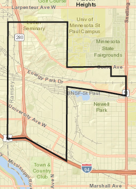
St. Anthony Park is located the northwest corner of St. Paul, bounded on the north by the cities of Lauderdale and Falcon Heights, on the west by the city of Minneapolis, on the south by I-94, and on the east by Snelling Avenue, the St. Paul Campus of the University of Minnesota, Cleveland/Transfer Road, and BNSF Railroad.
SAP Neighborhood Asset Map
Starting at our 2022 Joint Annual Meeting with the SAP Community Foundation, we have been asking neighbors what their favorite St. Anthony Park Community Asset is. We will keep adding to this map as we hear from you! Send your favorite asset (organizations, businesses, spaces, or parks) to info@sapcc.org.
New to the Neighborhood?
Support Local Businesses
- Small Businesses
- Nonprofits
- Local Food
Community Schools
Local Government
Community Resources
Who lives in SAP?
MN Compass helps us keep track and compare demographic data in the Twin Cities by neighborhood. Read more about our demographics on their site.
We have roughly 10,000 residents (up from 7,500 in 2010), over half of whom rent their homes. The majority of people who live in St. Anthony Park are white, but with growing diversity of people of color and non-native English-speakers. Our median household income, at $62,000 roughly, falls above St. Paul’s overall median income. Furthermore, we have a large student population with good access to both the St. Paul and Minneapolis University of Minnesota campuses.
Patterns within Saint Anthony Park
The population of Saint Anthony Park is quite diverse, and there are distinct geographic patterns that emerge when the area is broken down into smaller units.
What patterns or trends do you notice when taking a closer look at the neighborhood? Click on the button in the top left corner of the map to explore different topics.